
Porur lake, arc roads, and the Poonamallee–highway west
Valasaravakkam · Porur
Valasaravakkam and Porur are west Chennai’s lake-and-sprawl belt — tower blocks, colleges, and arc roads fed by Poonamallee and the Bengaluru highway, not Mount Road VIP closures and not OMR marsh flooding.
- Water: Porur lake & western bunds
- Feeders: Poonamallee · NH48 / Bengaluru highway
- Roads: Arc roads · flyover detours
- Life: Towers, colleges, community studios
Area pages
Reach customers in Valasaravakkam · Porur.
Hyper-local visibility on area guides where residents search for shops and services.
Highlights
Best of Valasaravakkam · Porur

Highlight
Porur lake belt
Lake views and western suburban sprawl meet Poonamallee and Bengaluru-highway feeders.
Highlight
Neighbourhood events
Studios, colleges, and community workshops keep Porur evenings busy beyond commute hours.

Highlight
Arc roads
Residential towers push peak pressure on arc roads — flyover works mean frequent detours.

Highlight
Western bypasses
Bus-route changes and bypass news usually touch this belt first — bookmark civic and mobility topics.
Corridor
About Valasaravakkam and Porur
Western suburban growth around a lake — highway feeders, not a CBD.
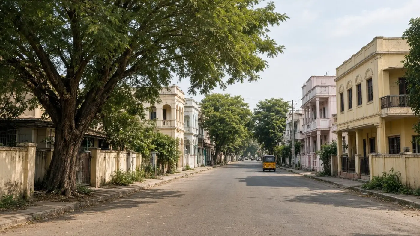
Porur grew around the lake and the western radials toward Poonamallee and the Bengaluru / Sriperumbudur highway. Residential towers and colleges push peak-hour pressure onto arc roads. Flyover seasons mean frequent detours.
Valasaravakkam (GCC Zone XI) is the denser western-suburban neighbour: mixed apartments, schools, and connector roads toward Arcot Road / Kodambakkam on one side and Ambattur on the other.
Civic stress is lake bunds and western storm-water, plus bypass and bus-route changes that usually touch this belt first. That is not Adyar estuary flooding and not Pallikaranai marsh on OMR.
Independent editorial context. Confirm ward numbers and official highways / GCC desilting notes. We do not publish live lake-level sensors.
| Lake | Porur lake and adjoining bunds |
|---|---|
| GCC ref | Valasaravakkam Zone XI |
| West feeders | Poonamallee and NH48 / Bengaluru highway |
| East / south feed | Toward Guindy interchange and Arcot Road |
| North feed | Toward Ambattur / Anna Nagar |
| Housing | Towers, older plots, college-adjacent rentals |
| Daily clock | College + office peaks on arc roads |
| Not this hub | T. Nagar retail, Adyar coast, OMR IT spine |
Neighbourhoods
Localities on this hub
Locality names and wards as on our Chennai map.
Valasaravakkam (GCC XI)
Porur
Western suburban growth near Porur lake; storm-water and bund stories matter each monsoon.
- Lake bund
- Suburban spread
Ward map
Explore on the Chennai map
Valasaravakkam and Porur wards highlight together — tap the lake belt and western connectors, then open mobility and civic news for this suburb.
Legend
Ward shapes are built from community GCC-aligned datasets (for example Datameet-style releases). They are editorial, not a legal survey — confirm license and official Greater Chennai Corporation geometry for authoritative use.
Tap a ward to see locality context. Open full-size map →
From mychennaicity.in
Local news for this area
News stories connected to this area.

Classifieds
Local listings
Reader-submitted ads tagged for this area hub.
No open classifieds tagged for this hub yet. Check Chennai classifieds for tuition, services, and wanted posts.
Advertisement carousel. Rotation pauses when you hover or focus inside.



Mobility
Commute, metro, and road works
Phase-2 CMRL and junction upgrades — verify dates on official CMRL / GCC channels.
| Arc roads & flyovers | Tower and college peaks stack on the same arc roads. Flyover works mean detours that change month to month — use official traffic channels, not screenshot forwards. |
|---|---|
| Poonamallee / highway feeders | Western bypass and NH48 movements dump onto Porur junctions. This is freight-and-suburb traffic, not Mount Road VIP closures. |
| Toward Guindy / airport | South-east hops share the Saidapet–Guindy–Alandur interchange. Delays there are west-Chennai news even when the destination is a terminal. |
| Toward Ambattur / Anna Nagar | North hops share western arterials and Inner Ring movements. Treat that hub as the neighbouring residential–MSME market. |
| Buses & last mile | MTC route changes on western bypasses usually touch this belt first. Last-mile from bus stops to tower gates is still share auto or two-wheeler. |
Civic life
What to watch in Valasaravakkam and Porur
Recurring themes in local civic reporting — not an official bulletin.
- Porur lake bunds and western storm-water — northeast monsoon notes differ from Adyar estuary and Pallikaranai marsh.
- Arc-road flyover detours — residential towers feel construction seasons as daily commute changes.
- Western bypass and bus-route notices — this belt is often first-touch; bookmark mobility news.
- College-evening and community-studio peaks — parking around Porur is not T. Nagar festival parking.
- Ward vs “Porur” postal name — confirm the GCC ward number before a civic complaint.
Living here
- Weekdays follow college and office clocks on arc roads; weekends add highway leisure and community workshops.
- This is not Anna Nagar’s planned grid and not OMR’s IT shuttle pattern — though both are a short hub away.
Shortcuts
Useful links for residents
mychennaicity.in pages and local community resources for this hub.
- Chennai local newsWestern bypass and civic stories when tagged
- Mobility newsBus routes and flyover detours
- Chennai classifiedsTower and college-adjacent rentals
- Chennai jobsWest Chennai and highway-edge roles
- Open on city mapHighlight Valasaravakkam–Porur wards
- Flood street-scoreEditorial monsoon context — not a live warning
City tools
Useful from this neighbourhood
FAQ
Common questions
Is Porur the same as Valasaravakkam?
No. Porur is the lake-and-highway-feeder suburb. Valasaravakkam is the denser Zone XI neighbour toward Arcot Road. This hub covers both because they share western arc roads and a labour market.
How is flooding here different from OMR or Adyar?
Stories here involve Porur lake bunds and western channels — not Pallikaranai marsh and not the Adyar river mouth. Use GCC notices for your ward; this page is not a live flood warning.
Why do flyovers matter so much?
Towers and colleges load the same arc roads. A flyover season changes every peak hop toward Guindy, Ambattur, or the highway. Confirm official traffic notes.
Is there Metro on this belt?
Do not assume a station from the neighbourhood name. Confirm the current CMRL map. Many trips still use buses plus last-mile autos toward Guindy or Anna Nagar transfers.
Where do west Chennai jobs show up?
Open roles we list appear on the Chennai jobs hub. Ask for a landmark on the arc road or highway feeder — “Porur” alone is a wide pin.
Is this an official GCC page?
No. mychennaicity.in is independent. Civic notes are editorial — verify ward numbers, lake works, and bus changes on official channels.
Join the mychennaicity.in reader group on WhatsApp
The mychennaicity.in reader group on WhatsApp — short updates and civil discussion, same standards as the site. The group link appears after you send your name and number.
Reach the team
Questions about coverage, corrections, or working with us — send a short message and we will route it to the right person.
New to the site? How to use mychennaicity.in — guides for residents, job seekers, WhatsApp admins, and more.
Who is this for?
How to use mychennaicity.in
Pick your role — we point you to the right pages for news, jobs, events, WhatsApp, and civic tools.
- ResidentsUse the site like a city desk: local news, your area hub, gold rate, and a moderated WhatsApp…
- Job seekersBrowse open roles, post that you are looking for work, and keep an eye on Chennai career guides.
- EmployersPost jobs, list your business, and reach Chennai readers without cold-spamming WhatsApp groups.
- Group adminsDefend your RWA, jobs, alumni, or neighbourhood group from invite-link spam — and point membe…
- EventsFind what’s on across Chennai, or submit a public event for the local calendar.
- Civic / mapFollow Corporation, Metro, and ward-level context with news plus interactive civic tools.